-40%
Argo Gold Mine, Gold Mining Claim, Mariposa County, CA (,800,000 waiting)!
$ 3960
- Description
- Size Guide
Description
Argo Gold Mine, Gold Mining Claim, Mariposa County, CA (,800,000 waiting at the 200 ft level)Item Description
Please make sure you can afford this claim before you put an offer in. I'm an willing to finance this claim, but you would have to have a minimum of half down on the agreed upon price. Please message me if this interests you, so we can discuss terms before you put an offer in.
GENERAL CLAIM DESCRIPTION
Meeting of the Mines is proud to offer The Historic
"Argo
Gold Mine
".
This is truly a unique opportunity to own a historic producing Gold Mine, rich in California history.
The mine has been virtually untouched for years and is ripe and ready for a beginner or seasoned Gold Miner.
The Argo Mine has yet to be mined to its true Gold yielding potential!
~
1000 tons of ore still left at the 200 foot level at 1 oz. per ton per the mining report from the Argo Mine below.
~
,800,000 at todays Gold prices at the 200 foot level waiting to be mined out
~
High-grade ore occurs in small shoots and pockets in which specimen gold is associated
~
Big and small rich gold bearing quartz veins (see photos)
~
Mine tailing still waiting to be processed
~
200 pounds of hand-picked processed ore from the Argo yeilded the gold in the picture above
~
The 3/4" wrench with gold was from the same processed ore that was stuck in my mill
~
Many
remnants of the old milling operation are still left on the claim
~
Hidden and secluded, with lots of privacy but rather easy accessability
~
M
assive camping area and several other areas on the claim for bigger or smaller 5th wheels
~
The claim is only 10 miles from the Historic town of Coulterville
~
The actual stamp mill that was located at the Argo Mine is now at the Coulterville Museum
~
This by far the best Lode Gold Mine that I have offered on Ebay.
The Argo Mine has proven to be a lucrative Gold mine in the past and can be again, especially with the 1000 tons of ore at the 200 foot level at 1 oz. per ton, that's some incredibly rich ore with todays gold prices at 00 an ounce this comes out to be ,800,000. This dynamic screams to the potential for an individual or individuals using new age methods and technology to profit from this fantastic opportunity! This is also an excellent spot for a small mining operation to work at a high profit from high grading the underground deposits or simply used as a piggy bank for some small miners equipped with a metal detector, cordless drill, cordless rotary hammer, Sierra Blaster kit, rock crusher, and Gold Hog Sluice chasing pocket gold. One good Gold specimen could be worth thousands.
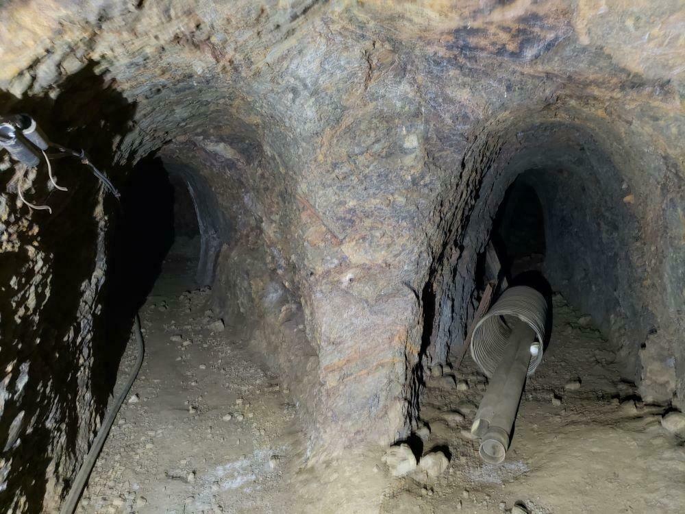
The adits are clean and stable, except for one area I have shown in the photo above, this portion needs to be retimbered. I did go beyond this point and felt pretty safe. The entrance is free of debri and actually rather hard to find unless you know what you are looking for. This is good though for the main reason that you don't have to worry about many people finding it. There is old wiring for lights and piping, along with other mining related items that were probobly from a miner back in the 70's or 80's that was going to work the mine, but never got to it.
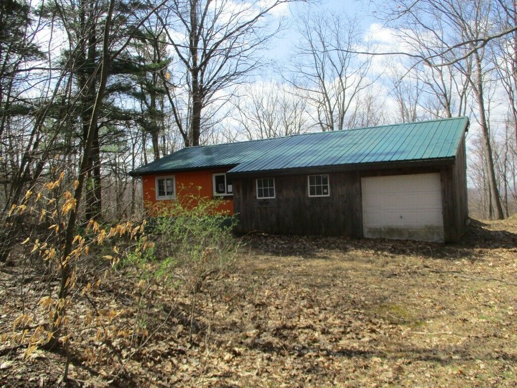
Workings consist of several open cuts, adits, stopes, and a 200 foot inclined shaft with several levels and stopes. Acess to the lower levels will have to be cleaned out of debri from over the years of inactivity of the mine. There is brown metal fence covering up a shaft shown in the photo above. I think this was done by the prior claim owner to stop anyone from accidently falling in. There is another shaft by the main camping spot shown in the photos above. Prior equipment on the property included a 4 inch jaw crusher, 3 stamp mill, amalgamating plates, 2 concentrating tables, a dismantled steam hoist and skip, wooden headframe and bin, and several buildings. All that is left of the items mentioned in the prior sentence is just remnants. Sufficient water for milling purposes was obtained from the mine.
Forest Route 2S42 does have some ruts and bumps to the point you park or camp (see road conditions above and directions below). 2 or 4 wheel drive in dry weather and 4 wheel drive during inclement weather conditions The trail head to the adit is where the main big clearing is located (see directions below). Follow the old remnants of the milling operation and you will find the tunnel. I can give gps coordinates upon request. There is places on the claim to put a bigger 5th wheel, but if you wish there is several RV parks are within minutes of the claim. There is just so much to do within minutes from this claim. See details below.
The
Argo
Gold
Mine
is located in a very rich mining district in the Sierra Nevada east gold belt. The chances of finding pocket gold are phenomenal. Gold Mines as good as this one don't come around very often and with gold prices sky-rocketing the
Argo Gold Mine
is prime for a gold-finding exploration.
So, whether you're a part-time prospector, full time gold miner, or dedicated metal detectorist, there has never been a better time to get involved in the modern-day Gold Rush! Not only is gold mining a hobby and or a full-time job that can pay you back, it's an activity the entire family can enjoy together in the great outdoors.
Perhaps one of the best benefits of gold prospecting, gold mining, and or metal detecting is that with the price of gold today, you don't have to find much to completely pay for your claim and equipment-- and the rest is pure profit!
This Gold Mine will give you lots of opportunity for finding big time gold. Here's your chance to own a great Gold Mine in a very rich mining district, which will bring years of joy and gold to your family and will always have
tremendous resale value
.
Mining claims are mineral rights to Government land and the rights to extract precious metals. They are considered real property and can be bought, sold, leased, willed, transferred and etc.
Check out August 2020 and November 2019 back issue of ICMJ's Prospecting and Mining Journal, Nov. 2019 is us on the cover with a feature on our Hard Rock operation and August 2020 is a fantastic follow up on our progress! Photo of magazines below.
Argo Mine
A former lode Au mine located in the NW¼ sec. 15 and in the NE¼ sec. 16, T2S, R17E, MDM, 4.0 km (2.5 miles) ENE of Greeley Hill, on the divide between Blackstone Creek and Jordan Creek (7 miles NE of Mariposa), on National Forest land. Property consisted of 2 unpatented claims. Operated 1923 to 1935, 1937 & 1949. Operated by Walter D. McLean. MRDS database stated accuracy for this location is 1,000 meters.
Mineralization is a vein deposit (vein & ore shoots), hosted in hornfels, quartzite, diabase and diorite. The ore body is pinch & swell in form, strikes N35W and dips 52E at a thickness of 1.52 meters. Controls for ore emplacement included a shear zone. The vein is 2 to 5 feet thick in blue-black quartz biotite hornfels, black quartzite and a medium-grained, altered intrusive rock, either diabase or diorite, with 2 ore shoots 100 feet apart. One about 40 feet long and 75 feet deep yielded 150 tons of ore from which 120 ounces of gold was extracted. According to the owner high-grade ore occurs in small shoots and pockets in which specimen gold is associated with quartz and pyrite. Local rocks include Paleozoic marine rocks, undivided, unit 4 (Western Sierra Nevada).
Ore remaining in the shoot on the 200 foot level is said to average about 1 ounce of gold per ton, from slightly more than 1000 tons of ore.
Workings include surface and underground openings with an overall depth of 60.96 meters and comprised of several open cuts and a 200 foot inclined shaft with several levels and stopes.
Production data are found in: Bowen, O.E., Jr. & C.H. Gray, Jr. (1957).
Total recorded production is about ,500 (period values). Worked intermittently between 1923 and 1935. During the winter of 1937 2 men recovered .00 (period values) worth of gold in 3 days from a soil mantle S of the shaft. The milling of 24 tons of dump material in 1949 yielded 18 ounces of Au, or an average of .25 (period values) per ton. Only assessment work has been done since 1949.
Kinsley Mining District, East Belt, Mariposa County, CA
Location, History, Geology, Ore Deposits, Mines
Location and History:
This is an extensive district in the Sierra Nevada East (gold) Belt in north-central Mariposa County. It is five miles east of Coulterville and about 25 miles north of Mariposa. The district includes several places that at various times have been classified as separate districts but are grouped together in this publication because they adjoin each other and are geologically similar. These are the Greeley Hill, Bull Creek, Gentry Gulch, Smith Ridge, and Dogtown areas. The Cat Town district lies just to the south and the Coulterville district to the west. The area was placer-mined during the gold rush. Much lode mining was conducted from the 1860s through 1900 and again in the 1930s. Several mines including the Hasloe and Horseshoe have been worked intermittently in recent years.
Geology:
The district is underlain by slate, mica schist, quartzite, hornfels, phyllites and limestone lenses of the Calaveras Formation (Carboniferous to Permian). Present are several small granitic stocks and a number of diorite, quartz-diorite and aplite dikes. In places these dikes are associated with the gold-quartz veins and are important in the localization of the ore bodies.
Ore Deposits:
Numerous north- and west-striking quartz veins range from one to five feet in thickness. The are shoots generally are small, but commonly rich. The are contains free gold and often abundant sulfides including galena and tetrahedrite, which are associated with rich ore. Molybdenite is present in a few places.
Mines:
Argo (,000), Bandarita (.52 million), Bob McKee, Bondurant (0,000), Bunce, Carrie Todd, Contention, Cranberry, Garibaldi, Gold King, Hasloe ( million), Horseshoe, Last Chance, Lovely Rogers, Louisiana, Marble Springs (0,000), Moonlight, Quail (0,000), Red Cloud, Red Mountain, Texas Hill (,000+).
Area Recreation and Nearby Towns
The claim is located approx 9.8 miles from Historic Coulterville, 13.9 miles from Historic Groveland, 33 miles from Downtown Sonora.
Yosemite Valley
floor is approx. 51miles. There is area to camp on the claim, but several lodges are nearby, Buck Meadows is the closest. Looking for a RV Park? Yosemite Westlake Campground & RV Park located in Greeley Hill only 3 miles away. Several other locations for RV parking are available in Groveland and near Yosemite.
Claim Particulars
The Argo Mine
The claim is in Section 15, Township 2S, Range 17E, Mount Diablo Meridian
One 20 Acre Placer Mining Claim
CAMC# 0323691
*GPS COORDINATES AVALIABLE UPON REQUEST
Driving Directions
From Coulterville, head EAST on Hwy 132/Greeley Hill Road for 8.4 miles, stay to the RIGHT to continue on Greeley Hill Rd for approx. 3 miles. You will make a sharp left ont, continue for approx. .4 of a mile.
**important to stay to the RIGHT to stay on Greeley Hill Rd, if you go left you will hit
Hwy 120, just follow maps below and you will be good**
It is 6.6 miles from Coulterville to Greeley Hill. This will be your LAST stop for gas/food/drinks before the claim. There is ONE gas station in Greeley Hill. There are NO gas stations in Coulterville. If you are coming up Hwy 132
from Modesto area, Don Pedro is the last gas station before hitting Greeley Hill.
From Greeley Hill you are only 3.5 short miles from the claim. Paved road all the way. The road does get a little bumpy but otherwise good.
PICTURE BELOW: Make hard left onto 2S42, this road DOES NOT have a sign, but if you put Forest Route 2S42 into Google Maps you will see it clearly.
PICTURE BELOW: After turning left onto Forest Rte 2S42, you will come to split in the road. Stay to the right as shown below. *note marker on stump*
PICTURE BELOW:
BLUE ARROWS
will take you to the main part of the claim and camp site.
GREEN ARROW
take you to additional camp areas.
PICTURE BELOW: Main campsite and mining claim area.
Top Left
: As you come down the road you will drive into a large opening. *note trail to Argo Tunnel is directly to the left after entering the camp area.
Enlarge picture on the right
shows the trail to
ARGO TUNNEL
.
Bottom Left
: Towards the end of the large opening there is a great spot to park a vehicle or 5th wheel on the left side; directly across from there is the trail to the
ARGO SHAFT.
PICTURE BELOW: FOREST RTE 2S42, gravel and dirt, fairly good road with notable areas that may require 4WD in winter months.
PICTURE BELOW: Bower Cave is not apart of this claim, but a short drive from the claim (3.7 miles).
Feedback:
If there are any problems please send me an email and I will do my best to resolve them.
If you have any questions, please email me. You are dealing with a real miner/prospector here.
Payment Details
Payment Information
Accepted methods of payment: Personal/Business checks, direct deposits or wire transfer, cashier's check and money orders. PayPal does not allow payment for real estate or land purchases and mining claims are considered real estate, so we are unable to accept payment through PayPal. No returns or exchanges, contact me with questions.
Transfer of Ownership
Once payment is received and clears, a deed will be filled out with your name or names and notarized transferring ownership to the new owner. Either you or I can mail (a lot of time I will hand deliver to the appropriate County and BLM) it to the appropriate County recording office and BLM, but I would rather do it so I know it’s done correctly, but of course that is your call. I will pay all transfer fees. If you purchase this claim or claims we will be sending you a packet with all the appropriate claim paperwork after the payment clears.
Additional Information
Meeting of the Mines takes great pride in finding claims for the serious miner and the hobbyist miner.
We do thorough research to ensure that we sell only open claims. Our claims never overlap a LOAD or PLACER claim,
we never top file!
The photos below show our current hardrock mining operation and equipment used.
Track Page Views With
Auctiva's FREE Counter
