-40%
GOLD MINE Historic Georgetown Lake MT Porter Mine Gold Mining Claim
$ 4538.16
- Description
- Size Guide
Description
Historic Porter Mine20.66 Acre Lode Claim - Red Lion District - Granite County, Montana
The Historic Porter Mine Mine for sale, a 20.66 Acre Unpatented Lode Mining Claim on federal land managed by the U.S. Forest Service. The claim is located just outside of Philipsburg, Montana in the Red Lion Mining District in Granite County, MT and has been properly marked. All claims have been carefully surveyed, mapped and researched. MMC #241852
The Porter Mine has an adit of several hundred feet.
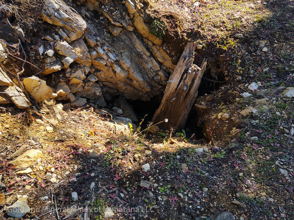
The Porter Mine claim is 20.66 acres. The Porter Mine claim is 20.66 acres. The claim consists of a collapsed adit and a partially collapsed inclined shaft.
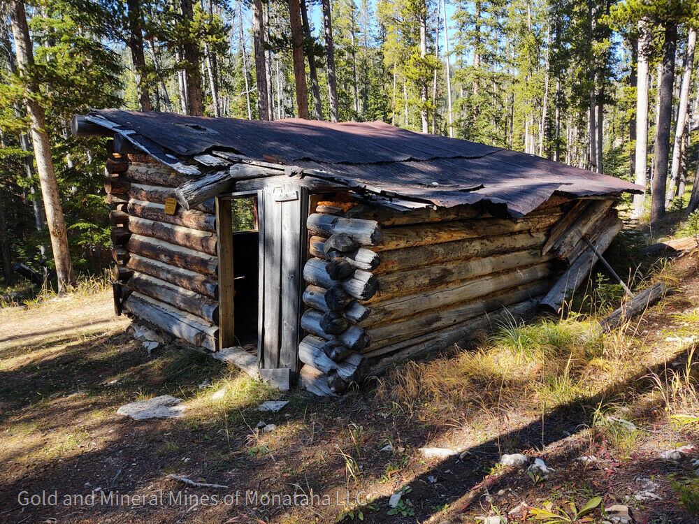
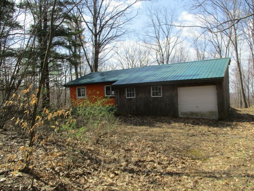
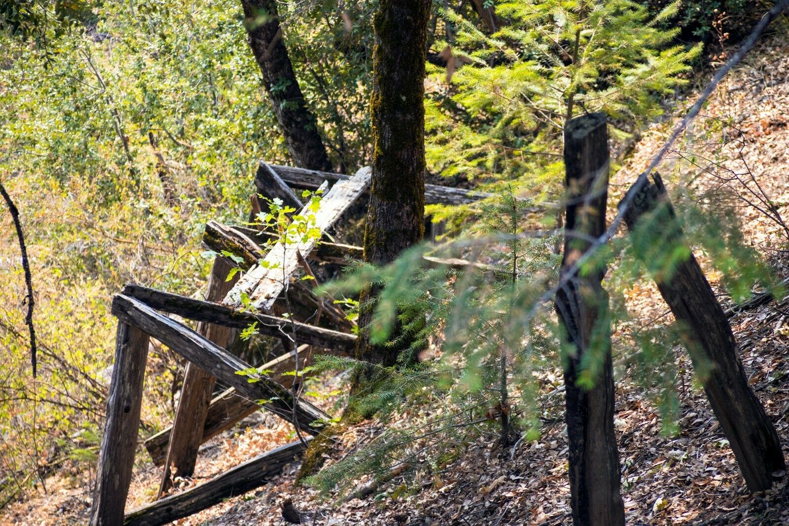
The Porter Mine Mine is a short drive out of Georgetown, MT. A dirt road winds up into the hills and right to the base of one of the dumps. This is an old and rarely visited area. The road runs to the base of the hill below the mine. There is a good spot for parking near the old cabin, in a small clearing at the mine. The claim covers a full 20.66 acres, and has been written to cover the general trend of the lode. There is an old cabin in disrepair.
When we visited it this past fall the adit was collapsed and we were not able to enter at that time. There is plenty of ore on the dumps. The Porter mine is low on the west slope of Cable Mountain, near the center of the Red Lion district. The mine is developed by two inclines and a short adit along a generally west-striking south-dipping vein structure in Hasmark Limestone. One small stope produced a few tons of oxide gold ore.
The tailings offer a good mining opportunity. Over the years some of the gold has washed down to the bottom of the tailings pile from the top. The previous miners used the best technology of their time but they left a huge amount of good ore behind in the tailings. In addition, sulfide ore was harder to treat back then and most times it was thrown out on the tailings piles at old mines. Some of the lode mines from the 1800's are full of gold to this day because the technology to process sulfide ore was not available back then so they threw it out and over time the ore has been sitting out in the weather oxidizing which then releases the gold. Many old mine dumps are very profitable for this reason alone. You'll find unprocessed gold ore throughout the hillside.
Huge amount of info not listed, so if your interested in a gold lode mine feel free to give me a call or text at 406 219 1497. Ken
The Bureau of Mines has estimated that demonstrated U.S. reserves of gold are 85 million ounces. Approximately one-half of the total resources are estimated to be by-product gold, while 40% of the remaining one-half (56 million ounces) could be mined for gold alone ... Most U.S. gold resources are in the nation's western states. About 80% of the U.S. gold resources are estimated to be in Alaska, California, Idaho, Montana and Washington. (Earthsearch, Inc. 1983)
Overview of The Mines
The Porter mine is low on the west slope of Cable Mountain, near the center of the Red Lion district. The mine is developed by two inclines and a short adit along a generally west-striking south-dipping vein structure in Hasmark Limestone. One small stope produced a few tons of oxide gold ore (MBMG Bulletin 84).
Native gold is widely distributed in the ore deposits. It occurs in small leaves or flakes in many deposits, but in the main it forms a fine dust included in quartz, pyrite, and arsenopyrite. The iron sulphides are nearly always somewhat auriferous. Native silver is an important ore mineral in the silver-gold fissure veins in granite and in the silver-bearing replacement veins in calcareous rocks. It occurs as thin sheets or as flakes which cut the quartzose ore, and has presumably been formed through the reduction of silver sulphides and other silver-bearing minerals. It is most abundant in the upper portion of the enriched zones of the lodes, but was encountered as far as 700 feet below the surface. Inasmuch as the unaltered primary ore in the lowest levels does not contain native silver, the mineral is probably wholly of secondary origin. Native copper is rare in the ores of this quadrangle. Silver and gold are the metals of chief commercial value in the Philipsburg quadrangle. Copper, however, is present in much of the ore and is a commercial asset in some deposits. Gold occurs presumably as the native metal, for the most part intimately associated with pyrite, arsenopyrite, and quartz. (Emmons and Caulkins 1913)
The altitude is 7,000 feet. The Porter Mine Mine is located in the southeast corner of section 22 and the northwest corner of section 26. It is short drive from Georgetown to the mine.
While it is sometimes said old mines have been 'worked out' as the saying means there is no gold left, the truth is "it is better to say they are worked over; it is also true that the primitive methods used and the wasteful haste to get rich indulged in, left much of the gold in the ground, so that improved methods ... will give even better results than those first obtained." (MBMG Open Report p. 466)
Montana is ranked 7th by the USGS for total gold production in the US and has 31 mining districts. Gold production for the 1800's to 1968 is 17.8 million ounces and large amounts of gold have been mined from 1968 to present. Geologists have predicted that based on the past and the geology of Montana that several large gold and silver deposits will be found and developed in the future.
Details about the Mine:
Access to the Mine
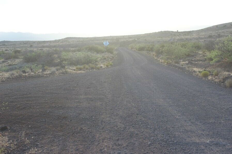
The road is maintained in good condition to the base of the claim. Road on the claim to the adit, inclined shaft and Ore Bin is passable when we visited. There is plenty of area to park a camper or RV prior to getting to the mine. We advise utilizing a side-by-side or 4 wheeler on your first trip to the mine to see how the road is.
Tailing Present
Surveyors estimate well over 6,000 tons.
Depth / Length
Drift of several hunrder feet and several cross cuts
Minerals in the Mine
Historically mined for gold and silver and copper. Minerals of quartz, pyrite, galena, gold, silver, black sands with rare earth minerals would be expected.
Foot traffic at the mine
Very little.
Last Worked
Unknown.
Number of Mines
Adits and cross cuts
Nearest city with amenities
Philipsburg, approximately 14.7 miles
Access to the Claim
A dirt road breaks off from the Interstate and leads all the way to the mine. Overall the road is in relatively good condition when dry. You will not be able to bring a camper or RV to this claim but there are plenty of camping areas prior to getting to the claim that an RV or camper can be parked.
Parking and Staging on the Claim
Claim is situated so it allows for parking and staging of vehicles (ATV's, UTV's) if desired.
Resources
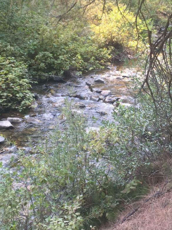
Year round water in the creek at the main road, grasses, sage and trees. More than enough trees on the claim for use in the mine.
Structures on claim
Cabin
Elevation
Aprox. 6700 feet
Total Workings
Over several hundred feet of workings which are cut along a gold rich ore body. At the present time the adits are collapsed.
Photos
The Porter Mine mine is ready for small miner production as defined under casual use.
This is the perfect place to mine undisturbed by yourself.
With a little work the adits could be opened.
If you've been looking for a hard rock mine this one should interest you.
Tucked away in the forest it appears no one visits this mine.
Climate / Weather
USGS Information
Economic information about the deposit and operations
Operation Type
Lode
Development Status
Past Producer
Commodity type
Metallic
Commodities
Gold- Primary
Silver - Primary
Copper - Secondary
Telurium - Tertiary
Bismuth - Tertiary
Length of workings
1000 ft drift
Host Rock
Cambrian, undifferentiated
Deposit
A NUMBER OF VEINS. THEY STRIKE N6E TO N50E AND D1P CONSIDERABLY WITH BEDDING
References
USGS Database - 10245740, 60000358, 10019685
Mining District Information
Red Lion District
Activity in the Red Lion district, northeast of Georgetown Lake at the headwaters of the North Fork of Flint and Fred Burr creeks, began in the late 1880s when the Red Lion lode was located. By 1891 a 10-stamp mill was built on the North Fork of Flint Creek to work the mine's ore, but early milling efforts fell short and nearly half the gold values were lost (Swallow 1891).
Geologically, the sedimentary rocks in the district range from Newland limestone (Beltian) to the Madison limestone (Mississippian). The structure is complexly modified by a fault line which in the western part of the district brings the Newland Limestone in contact with the Jefferson formation. Beds are offset by many cross-faults with a general northwest trend. The granodiorite of the Philipsburg batholith cuts off sedimentary deposits in the northern portion of the district. Ore deposits occur as replacements in limestones, fissure-fillings cutting various sediments and as contact deposits in limestone (Sahinen 1935).
The Milwaukee Gold Extraction company was formed in 1901 and spent ,000 acquiring all of the operating properties in the district. The Hannah mine and the Red Lion district as a whole were actively promoted by the company with reports of one vein 5 feet wide carrying per ton in gold and another vein 60 feet wide carrying per ton in gold. Plans were made for a new 100-ton amalgamation and cyanidation mill and a town site was platted; the new mill was to be a mile closer to the Hannah mine than the old Red Lion mill. This vein was 60 feet wide and carried 40 percent iron in addition to its gold values. A 3,800 foot long tramway was installed in 1905 to deliver ore from the existing Hannah shaft to the mill site. In the summer of 1906 a stamp mill and bunkhouses for the mill workers were erected. This marked the district's zenith; 200 men were employed and two mills were reported to be active. One of these mills was the rarely active 3-stamp Dougherty mill which was rated at only 40 tons per day. The other mill was the new Milwaukee Gold Extraction mill, but there was no evidence that any ore was actually run through the mill. No tailings were observed below the mill and the tramway showed rust but no wear. The investment in the development of the mine and mill exceeded the actual values of the available ore (Earll 1972).
In 1912 the operation was taken over by W. B. Rogers of Anaconda. The tunnel was extended to 600 feet and several shafts had been sunk on the vein. Mining at the Hannah was brought to a close by foreclosure in 1914. A new company, the Badger Montana Company, took over development of the mine after the foreclosure. On the Thurston claim 300 feet from the mill site an adit was begun which was projected to extend 700 feet to the Hannah vein. Unfortunately, little or no ore was found. The mill was destroyed by fire during World War II as part of an effort to extract metal from the mill for the war effort (Earll 1972).
Other important mines in the district include the Modoc, American Flag, Montana, Greater New York, St. Thomas, Golden Eagle, Flint Creek, Northern Cross, Yellow Metal, and Nineteen-Hundred. In 1912, the important mills of the district were the American Flag, Dougherty and Red Lion. All employed both cyanidation and amalgamation. The American Flag mill had a capacity of 50 short tons per day. The Dougherty stamp mill had a capacity of 40 short tons per day. The Red Lion 10-stamp mill could process 30 short tons per day (Hall and Rickman 1912; Wolle 1963).
The Flint Creek mine is located about 1,500 feet north of the Golden Eagle. Several tunnels, the longest being 1,000 feet long, were dug to find the source of rich quartz float. The adit cut a number of narrow veins and some were stoped. These veins were either fissure fillings or sheeted zones in quartzite. None appeared to be the source of the float. Ore was hauled out by wagon and treated in the Gold Coin mill near Silver Lake. The operation was said to have produced several thousand dollars worth of ore (Emmons and Calkins 1913).
MAPS
Sales Information
Gold and Mineral Mines of Montana LLC Guarantee
The most important part of your mining claim is the mining claim documentation and location. Others may have the best intentions, but they often get it wrong. This results in you not getting what you paid for. We have been documenting, writing and transferring mining claims for over a decade. We know what we are doing.
Gold and Mineral Mines of Montana LLC guarantees that this mining claim has been written correctly and accurately. Please view all images and read complete claim description. We spend a lot of time and effort to accurately document all aspects of each mining claim.
This Guarantee is not any type of guarantee of mineral content, reserves or future earnings. Assay reports, reserves, and mineral values are provided as they have been recorded by external parties, and state and local mining reports. Historical records and production are provided for information only. We strongly advise all potential claim owners to educate themselves about mining claims. Please be fully aware of what is conveyed with this mineral claim.
FAQ
Mining claims are a tangible asset and show your rights to all interests in minerals in the claim boundary. They can be bought, sold or used as collateral, just like any other piece of real estate. A mining claim can be sold, traded, leased, gifted, willed, used as collateral or transferred in part or in its entirety just like any other real property using a quit claim deed which is a recordable conveyance.
This auction is for 100% - all interest in this Lode mining claim. This claim covers the entire site and includes full rights to all minerals and gems you may find on the property. The winner of this auction will receive a notarized quit claim deed to the full claim and all associated documentation showing full ownership of the claim.
Maintenance on all BLM mining claims is 5.00, per 20.66 Acre or smaller parcel, annually. This must be paid on or before September 1st, every year unless you do more than 0 per year in improvements to the property, in which case you can file for and receive a waiver of the maintenance fee.
NOTE
: If you own fewer than 10 claims nationwide, and you perform at least 0 in assessment work in the year, you can plan on paying just per year for your maintenance fee instead of 5 if you file for a small miner waiver and have done the maintenance work required on the claims.
Transfers of Ownership in Mining Claims:
Interest in a legally valid and properly recorded mining claim or site may be transferred in part or its entirety. So you can will, gift, sell or lease your interest in this claim at any time in the future. A quit claim deed or recordable conveyance document is required and if you do sell the claim, the transfer documents should be filed within 60 days after the transfer.
With regard to transferring this claim initially into your name, we take care of all the paperwork. You do not have to worry about anything – we handle the County and BLM transfer documentation and the recording.
Can you camp / build on your mining claim?
Without an approved plan of operations, you have the same rights and restrictions as the public. If the area is open to camping to the public, then it is permissible for you to camp. However, you need to check with the BLM Field Office or the local District Ranger for areas open to camping. Under Federal law in order to occupy the public lands under the 1872 mining laws amended, for more than 14 calendar days in any 90 day period, a claimant must be involved in certain activities that (a) are reasonably incident; (b) constitute substantially regular work; (c) are reasonably calculated to lead to the extraction and beneficiation of minerals; (d) involve observable on-the-ground activity that can be verified; and (e) use appropriate equipment that is presently operable, subject to the need for reasonable assembly, maintenance, repair or fabrication of replacement parts. All five of these requirements must be met for occupancy to be permissible.
Proud Member of:
Legal Info
A mining claim gives the holder the right to mine on mineral-rich land that belongs to the federal government.
Gold And Mineral Mines of Montana LLC is selling legitimate and valuable historic claims.
Our legal counsel will complete all of the paperwork and documentation for recording and transferring FULL ownership of this mine into your name if you win the auction, AND we will ship you everything in one to two business days of receiving your payment in full. So you can plan to visit (and start working) your claim right away.
BID WITH CONFIDENCE- We are a very reputable eBay seller.
-PLUS-
We'll take care of all the paperwork and arrangements so you can enjoy your claim immediately after payment and keep you informed through the entire process with confirmations when payment is received and when your paperwork has been shipped.
Shipping
We are unable to ship the land to you.
We will ship all paperwork/maps upon payment clearing.
Payment
Your payment of this eBay item gives you 100% ownership of this entire claim,
in addition to the final auction price there is a 0 fee for filing and administrative costs
. This is NOT an auction for the down payment, this is NOT a partnership arrangement where someone else will own part of the claim with you.
At the end of the auction we will send a PAYPAL PAYMENT REQUEST for payment to your email address on your profile with eBay. We do NOT use ebay for payment processing. Ebay may send you an email wanting you to pay through thier system but if you try to use the ebay link it won't work. Ebay is attempting to force all sellers to open a payment processing account with them so they can charge sellers more. We prefer Paypal because we can control our costs better and pass that savings on to you.
Payment is required within 24 hours of the end of the auction. Payments must be made before the claim will transfer and documents are shipped.
© 2021 montanagoldandmineralmines . com
