-40%
GOLD MINE Historic St. Regis MT Crazy Kate's Gold Placer Gold Mining Claim
$ 557.04
- Description
- Size Guide
Description
Historic Crazy Kate's Gold20 Acre Placer Claim - St. Regis District - Broadwater County, Montana
The Historic Crazy Kate's Gold Placer Mining Claim for sale, a 20 Acre Unpatented Placer Mining Claim. The claim is located just outside of Superior, Montana. MT105236964
This is a remote Montana gold mine. The Crazy Kate's Gold Placer Gold Claim offers impressive mining opportunities. An extensive amount of gravel bars as well as the natural streambed support productive gold recovery. The claim is suited for most types of gold mining activities from panning, sluicing and high-banking to metal detecting, dowsing and more. Little Joe Creek runs through the middle of the claim, provides plenty of year round water for all your mining needs. During surveying gold was easily found in the material by panning. The valley bottom is old river bed material. The higher benches also hold old river bed material. The claim boasts excellent access and does get visitors driving through on the road. The claim was originally surveyed and sampled for rich, free gold deposits in the gravels. There are plenty of areas to camp near this claim. This is a unique claim that is in a valley of old river bed.
There are several fallen giant cedar trees along the creek bank; the root masses of these massive trees are ripe for metal detecting. The creek bed is over 600 feet on this claim and there is water year round. It is likely there is some native silver, sapphires, and possibly some relics to be found on the claim but the primary commodity will be gold. The road to the claim is accessible from May through snowfall, normally late November. The road is maintained and is in very good condition. 4-Wheel drive is not required. This is not a claim to pass up!
Little Joe Creek offers a wealth of gravel bars and hard-packed streambed; ideal spots to high-bank, sluice, metal detect, or pan. It is likely there has been some work done after 1900 based on the remnants and items seen in the area. It is estimated by the surveyors that the claim has been worked intermittently in the early 1900's. No effort to mine for many decades is evident. The gold that you will find on this claim has been washing down from the mines, hills and gulches above and depositing and replenishing the gold on this claim. There is plenty of room to setup your sluice or highbanker and shovel material right next to it or bring it from the wide valley floor that is the old river bed. There is plenty of opportunity here!
There is direct road access to this claim and room for staging, parking and other operations. This is an unpatented mining claim for sale. Mineral rights only for recreational mining. The land is public land. This is not a homestead or land for sale.
The best gold is on bedrock. Little Joe Creek is one of the creeks in the district that was mined by hand in the late 1800's. There is still good gold in the creek, benches and on bedrock on this claim.
The Bureau of Mines has estimated that demonstrated U.S. reserves of gold are 85 million ounces. Approximately one-half of the total resources are estimated to be by-product gold, while 40% of the remaining one-half (56 million ounces) could be mined for gold alone ... Most U.S. gold resources are in the nation's western states. About 80% of the U.S. gold resources are estimated to be in Alaska, California, Idaho, Montana and Washington. (Earthsearch, Inc. 1983)
Overview of the Mines
The Crazy Kate's Gold Mine is in an area with rich gold mining history. Estimates by Lyden (1948, p. 98-103) suggest that placer production before 1904 may have exceeded 120,000 ounces. But as with all old mines and mining districts in the Western U.S., the old timers NEVER got it all! Why? There are many reasons for this and here is a short list of some of them.
1) In the mining camps 'News' of other 'Strikes' was always coming in and miners seemed to be eager to pick up and leave what they had for the new locations. It didn't seem to matter that the new location may not be as good or that by the time they heard of it there wasn't any open ground left for them to stake a claim. The grass is always greener was their belief.
2) Some new strikes were better because they had more gold or more water or easier access - remember back then there were no roads to these places.
3) Some new places were safer. Between outlaws, hostile indians and bears and other wildlife there was always something to fear.
4) When the USA entered the second world war congress closed all non-essential mines in the country. Unless a mine could switch to mining other metals for the war they were forced to close. Very few mines were allowed to stay open and operational. Those mines that closed stayed closed after the war for a few reasons - a lot of the mine owners died in the war and/or never came back, economic conditions after the war were not good enough to reopen the mines and the many owners held the claims hoping the economy would change for the better but most of these owners died before the economy made it economically viable to reopen the mines, many mines were forgotten and 'lost'.
So why hasn't anyone claimed these mines now? Mainly the population wrongly believes there is 'no gold left'! If they only knew the truth the west would be flooded with people. Seriously, there is gold almost everywhere in the west and in places where there has been no history of production and places the old timers never found! The ground the old timers mined still holds gold for many reasons. First, the methods they used were not the best. Second, they were in a hurry to get rich and they looked mostly for the easy gold and threw out the material that held a lot of small gold. Third, they didn't have the ability to process some ores to get the gold. There are books written by people who had first hand accounts of the gold rushes, especially from the Klondike Gold Rush, and they talk about the miners only being interested in the big nuggets of gold and not 'wasting' their time on the small stuff. The women came behind them and picked small gold nuggets out of the 'waste' piles!! Even then that still left a lot of fine gold. Technology and knowledge is on your side now days. We know more and have equipment that will trap the big stuff but also the tiniest pieces even down to minus 400 mesh and smaller. Yes, -400 mesh is so small a single piece of gold that size won't look like gold. But a hundred of them together will!
Also think about the current state of the country and all that is going on, this could be your last chance to own a gold mine - your own bank. We sell a lot of mining claims and everyone tells us how happy they are with them. People first want the gold for the value but once they get out to their own claim they love the freedom they have to work and enjoy the great outdoors. Don't wait, get your own gold mine before it's too late. The Crazy Kate's Gold mine is located in the southwest quarter of section 35. Crazy Kate's Gold claim is about 3000 feet in altitude.
While it is sometimes said old mines have been 'worked out' as the saying means there is no gold left, the truth is "it is better to say they are worked over; it is also true that the primitive methods used and the wasteful haste to get rich indulged in, left much of the gold in the ground, so that improved methods ... will give even better results than those first obtained." (MBMG Open Report 466)
Montana is ranked 7th by the USGS for total gold production in the US and has 31 mining districts, including the St. Regis mining district, located in Mineral county. Gold production for the 1800's to 1968 is 17.8 million ounces and large amounts of gold have been mined from 1968 to present. Geologists have predicted that based on the past and the geology of Montana that several large gold and silver deposits will be found and developed in the future (Bergendahl and Koshmann, 1968).
Details about the Mine:
Access to the Mine
You can drive a full size truck or RV to the mine.
Tailing Present
Some. Loose gravels in the creek bed of small pebbles to larger boulders. Boulders are great places for the gold to hide. Benches on both sides of the creek are virgin ground.
Depth / Length
Over 600 feet of creek bed gravels. 1320 feet side to side with gold bearing benches.
Minerals in the Mine
Historically mined for gold. Minerals of sapphire, quartz, pyrite, galena, silver, black sands with rare earth minerals would be expected.
Foot traffic at the mine
Some
Last Worked
Unknown
Number of Mines
1 Placer
Nearest city with amenities
Superior, approximately 12 miles
Access to the Claim
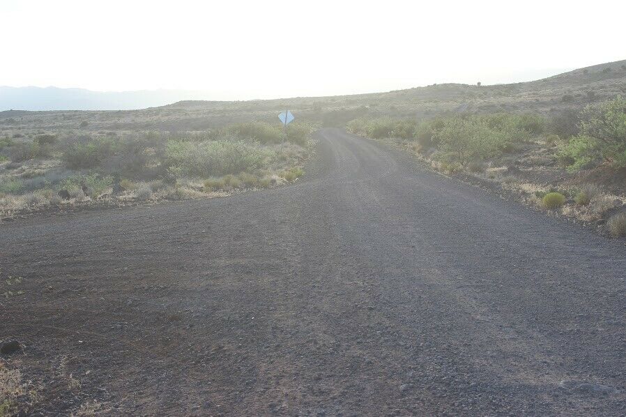
A very good dirt road breaks off from the Interstate and runs all the way onto the claim.
Parking and Staging on the Claim
Claim is situated so it allows for parking of vehicles if desired.
Resources
Year round water, grasses, sage and trees
Structures on claim
None
Elevation
Aprox. 3000 feet
Photos
This is the perfect place to mine undisturbed by yourself.
Or bring the whole family and have a lot of fun in the great outdoors!
All the gold flows into the creek from mines above and enters this claim.
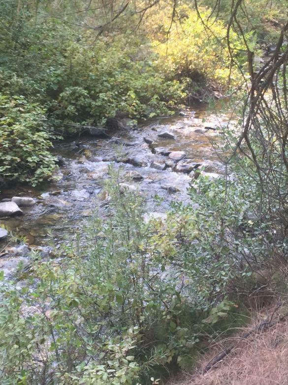
Creek is ready to set your stream sluice in it!
Both the bench and creek bed hold gold and are well worth your efforts.
There is plenty of gravel in the creek bed as well as the benches which are virgin ground.
Over 600 feet of creek bed to mine and 20 acres of gold bearing material
Climate / Weather
USGS Information
Economic information about the deposit and operations
Operation Type
Placer
Development Status
Past Producer
Commodity type
Metallic
Commodities
Gold- Primary
Nearby Scientific Data
Wallace formation
Rock Type
Unconsolidated Deposit > Sand and Gravel
Deposit
PLACERS WITHIN THIS AREA ARE INTIMATELY ASSOCIATED WITH NEARBY LODE DEPOSITS
References
USGS Database - 10270254, 10010237
Mining District Information
St. Regis
The St. Regis district is located along the eastern slopes of Bitterroot Mountain range. The area is between the St. Regis River and crest of the Bitterroots and includes the town of St. Regis, a station on the Northern Pacific and Chicago, Milwaukee, and St. Paul Railroads. The district was of some significance from 1920 into the mid-1930s. The lode mines contained gold, silver, copper and lead-bearing ores. Some gold has been recovered from placers along the St. Regis River as well.(Sahinen 1935; Lyden 1948).
The district lies in an area of Beltian rocks, through which the St. Regis River cuts. Northeast of St. Regis the Beltian rocks are quartzites and argillites of the Ravalli group. To the southwest, the shales, slates and impure limestones of the Wallace formation appear as outcrops. Ore deposits occur as placers and veins. Veins carry gold ores and silver, copper and lead ores. Some of the mines have exposed a good grade of sulphide copper ore (Sahinen 1935).
The town of St. Regis lies 14 miles west of Superior, at the confluence of the St. Regis river and the Clark Fork River. The town served as a rail station, as well as a sawmill town and supply center for loggers. The town was already considered as the "old town" by 1910 when a large forest fire forced its temporary abandonment. The town boasted a few notable buildings including Peter Rabbit's saloon and stage station, also called "The Kitchen" (Wolle 1963).
No production information is available on mines in the district prior to 1913, but the Lenora, and St. Lawrence, Oro Fino and Amazon Dixie in the adjacent Denemora district, reported production more or less continuously from 1917 to the mid-1930s (Sahinen 1935; WPA 1941).
Located along the Idaho border, Mineral County was formed in 1914 by a partition of Missoula County. The county derives its name from the diverse array of minerals including lead, copper, zinc, silver, and gold located in its mountainous terrain. The county has a rich historical heritage of mineral discoveries in the late 1800s. Gold and silver were commercially produced from mines located in Mineral County. All gold mined before 1914 from the area now included in Mineral County is credited to Missoula County.
Almost all of the entire gold output in Mineral County came from placer deposits along the creeks that drain the east side of the Bitterroot Mountains and that flow into Clark Fork River.
The gold recovered from the placers was considered to be exceptionally rich, ranging from .75 to .45 with a standard price of .67 per ounce.
In 1875 it was reported that the various drifts were yielding as high as 0 to 0 to a set of timbers, and that about ,000 in gold was recovered each year from 1871 to 1873. The fineness was reported as ranging from .950 to .982 (Sahinen 1935; Lyden 1948).
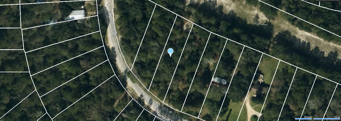
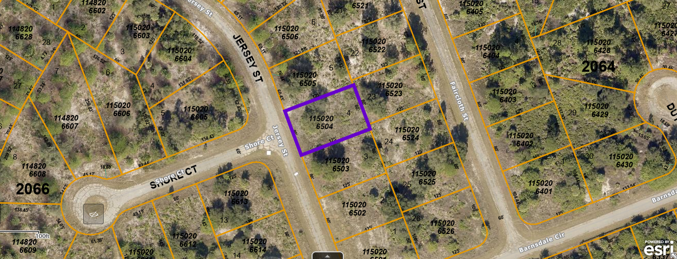
MAPS
Sales Information
Gold and Mineral Mines of Montana LLC Guarantee
The most important part of your mining claim is the mining claim documentation and location. Others may have the best intentions, but they often get it wrong. This results in you not getting what you paid for. We have been documenting, writing and transferring mining claims for over a decade. We know what we are doing.
Gold and Mineral Mines of Montana LLC guarantees that this mining claim has been written correctly and accurately. Please view all images and read complete claim description. We spend a lot of time and effort to accurately document all aspects of each mining claim.
This Guarantee is not any type of guarantee of mineral content, reserves or future earnings. Assay reports, reserves, and mineral values are provided as they have been recorded by external parties, and state and local mining reports. Historical records and production are provided for information only. We strongly advise all potential claim owners to educate themselves about mining claims. Please be fully aware of what is conveyed with this mineral claim. We do not guarantee suitability for any particular type of mining.
FAQ
Mining claims are a tangible asset and show your rights to all interests in minerals in the claim boundary. They can be bought, sold or used as collateral, just like any other piece of real estate. A mining claim can be sold, traded, leased, gifted, willed, used as collateral or transferred in part or in its entirety just like any other real property using a quit claim deed which is a recordable conveyance.
This auction is for 100% - all interest in this placer mining claim. This claim covers the entire site and includes full rights to all minerals and gems you may find on the property. The winner of this auction will receive a notarized quit claim deed to the full claim and all associated documentation showing full ownership of the claim.
Maintenance on all BLM mining claims is 5.00, per 20 acre or smaller parcel, annually. This must be paid on or before September 1st, every year unless you do more than 0 per year in improvements to the property, in which case you can file for and receive a waiver of the maintenance fee.
NOTE
: If you own fewer than 10 claims nationwide, and you perform at least 0 in assessment work in the year, you can plan on paying just per year for your maintenance fee instead of 5 if you file for a small miner waiver and have done the maintenance work required on the claims.
Transfers of Ownership in Mining Claims:
Interest in a legally valid and properly recorded mining claim or site may be transferred in part or its entirety. So you can will, gift, sell or lease your interest in this claim at any time in the future. A quit claim deed or recordable conveyance document is required and if you do sell the claim, the transfer documents should be filed within 60 days after the transfer.
With regard to transferring this claim initially into your name, we take care of all the paperwork. You do not have to worry about anything – we handle the County and BLM transfer documentation and the recording.
Can you camp / build on your mining claim?
Without an approved plan of operations, you have the same rights and restrictions as the public. If the area is open to camping to the public, then it is permissible for you to camp. However, you need to check with the BLM Field Office or the local District Ranger for areas open to camping. Under Federal law in order to occupy the public lands under the 1872 mining laws amended, for more than 14 calendar days in any 90 day period, a claimant must be involved in certain activities that (a) are reasonably incident; (b) constitute substantially regular work; (c) are reasonably calculated to lead to the extraction and beneficiation of minerals; (d) involve observable on-the-ground activity that can be verified; and (e) use appropriate equipment that is presently operable, subject to the need for reasonable assembly, maintenance, repair or fabrication of replacement parts. All five of these requirements must be met for occupancy to be permissible.
Proud Member of:
Legal Info
A mining claim gives the holder the right to mine on mineral-rich land that belongs to the federal government.
Gold And Mineral Mines of Montana LLC is selling legitimate and valuable historic mining claims.
Our legal counsel will complete all of the paperwork and documentation for recording and transferring FULL ownership of this mine into your name if you win the auction, AND we will email you everything in one to two business days of receiving your payment in full. So you can plan to visit (and start working) your claim right away.
BID WITH CONFIDENCE- We are a very reputable eBay seller.
-PLUS-
We'll take care of all the paperwork and arrangements so you can enjoy your claim immediately after payment and keep you informed through the entire process with confirmations when payment is received and when your paperwork has been shipped.
Shipping
We will email all paperwork/maps upon payment clearing.
Payment
Your payment of this eBay item gives you 100% ownership of this entire claim,
in addition to the final auction price there is a 0 fee for filing and administrative costs
. This is NOT an auction for the down payment, this is NOT a partnership arrangement where someone else will own part of the claim with you.
At the end of the auction we will send a request for payment to your email address on your profile with eBay. Payment is required within 24 hours of the end of the auction. Payments must be made before the claim will transfer and documents are sent.
© 2021 montanagoldandmineralmines . com


